Havglimt and Sjøglytt – Hub for knowledge
The two day trip cabins Havglytt and Sjøglytt are located in an exciting and valuable cultural landscape! Vestland and Rogaland county councils have established the project Hub for knowledge. It uses the day trip cabins as an arena for sharing knowledge about the cultural landscape around the cabins.
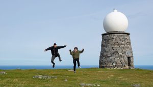
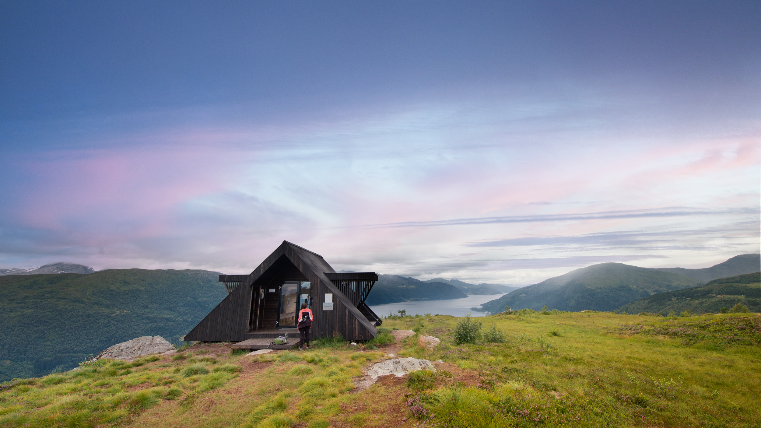
Havglimt (Glimpse of the sea)
Havglimt is located in the hillside directly below Lundebrekkhornet down towards Nollen. The cabin has a view both to the center of Leikanger and beyond the Vanylvsgapet, where you can see the Stadthavet in the distance. There is also a panoramic view of the whole of Sunnmøre.
The cabin has great utility for schools and kindergartens. Nice for camping beside the cabin and opportunities to go on to Lundebrekkhornet or other peaks. Here is wood, a toilet and electricity via solar cells. Not accessible with prams or wheelchairs. Visit UT.no for hiking trails.
You can park for free at Stadlandet school or at the kindergarten if it is full. Please do not park at the bus stop or drive into the housing estate.
The hiking trail is 2 km one way, and takes approximately 0.5-1 hour.
The trail to the cabin
There are several different paths that lead to Lia, but only one is marked and official:
From the school, follow the road to the top in the housing estate behind the school (500m) and turn right at the last bend before the top. Follow the marked path uphill (400m) until you come to a field. Then turn left inwards and follow along the fence on the upper side (600m). Here you will find a picnic table to rest tired legs. Over a bridge and to the right on a path/road up along the river (400m). Here you will once again find a picnic table where you can enjoy the view and gather strength before the summit. Turn left, the last 150 m is not a trail.
Sjøglytt (An opening to the sea)
Sjøglytt is located on Risnakken, just above the centre of Selje.
Parking is free in Selje, and you can park in the center or by the school. If you come by paddling, you can park your kayak at BUA/Seljesanden, and for boat travelers there is a guest harbor in Seljevågen.
Are you arriving by bus? The closest stop is the bus shelter at Selje school. By boat: walk from the harbour towards Seljesanden, where the trail up the hill begins.
The trail to the cabin
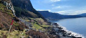
The hike starts in Skogaveien by Doktorgården. Walk about 100 metres on the road in the direction of the church. There, you will see signs and the start of the stairs towards Risnakken on the right side of the road. The stairs are steep but solid. The trail is lit and can be used all year round. From Risnakken, there is a marked trail further towards Kvenshusdalen (where there is a fishing lake) and on to the second highest peak in Selje: Tarvaldseggja. You can also choose to return and complete the hike as a shorter round trip. There is a trail from Risnakken to Djupedalen. Risnakken is equipped with outdoor fitness equipment, a lean-to shelter, and a play area. Not least, there are fantastic views of Selje centre, the beach, Selja, the Stad peninsula, and Stadthavet.
The cabin is located at about 135 metres above sea level. The hike up takes 10-30 minutes depending on your pace. The trail up to the cabin is 0.7 km long.
Visit UT.no for hiking trails.
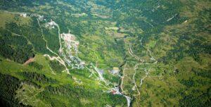
Naustdalskamben
Naustdalskamben is located about halfway between Stårheim and Nordfjordeid and has views both into Nordfjordeid town centre and out across the Nordfjord.
The closest parking is found at the commercial area at Reset, at Haugen school, or at Stårheim stadium, depending on which route you choose to take to the cabin. Follow the Rv. 15 to get to all three starting points. To get to Reset, you can either drive Bjørhovdevegen or follow county road Fv. 5747 to Hjalmavegen. Both roads intersect at Hjelmeland. Here, turn off to Remmedalen. Follow this road until you see a sign for parking for the day trip cabin.
There are several different trails leading to Naustdalskamben.
From Reset in Hjelmelandsdalen: see the trail map on UT.no. This is the least steep and most family-friendly route. Follow the gravel road into the commercial area. The trail starts at the end of the road. The trail is marked with red posts and is well-worn for the first 500 metres, then continues on a tractor road until you reach the trail from Grøthaug / Haugen after 1.5 km. There is a good trail all the way up to the top starting at the forest clearing. The trail is well-worn and easy to find. At the top, the trail flattens out and the terrain is a little marshy on the last stretch to the cabin. The hike to the cabin is 3.2 km in total.
From Haugen school: see the trail map on UT.no. Parking at Haugen school. The hike is 2 km on asphalt and 2 km on terrain.
From Torvik in Stårheim: here, there is a recently cleared, marked trail. Parking at Stårheim stadium. The starting point is by the bridge that crosses the river at the power plant. The trail is marked with blue posts all the way to the top.
For a short but steep alternative, there is a marked trail starting at Naustdal by the Rv.15 in the 80 km zone between Stårheim and Haugen.
All of the hikes take between 45 minutes and 1.5 hours depending on the starting point and pace. The cabin is located at 475 metres above sea level.